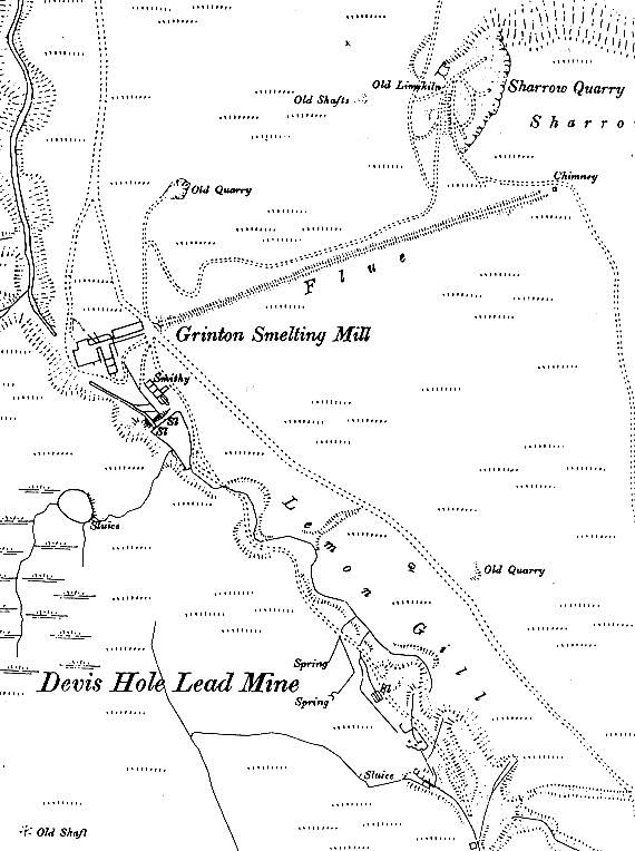
1891 Map of Grinton Smelt Mill and Surrounding Area
1891 map of Grinton Smelt Mill and the surrounding buildings and area. Note the mill pond and dam with two sluice gates (SL): the one on the left allowed for draining and to prevent overflow, the other provided water to the wheel via the wooden leats. The 'Smithy' building was demolished but the foundations can still be seen. Note also to the NE Sharrow Hill Quarry and the limekilns. The quarry would have provided stone for the building work and the limekilns would have provided lime for producing mortar. As a byproduct lime would have been supplied to local farms for fertilizing and improving their fields.
Image: © Northern Mine Research Society.