WW1 Aerial Photo and Map
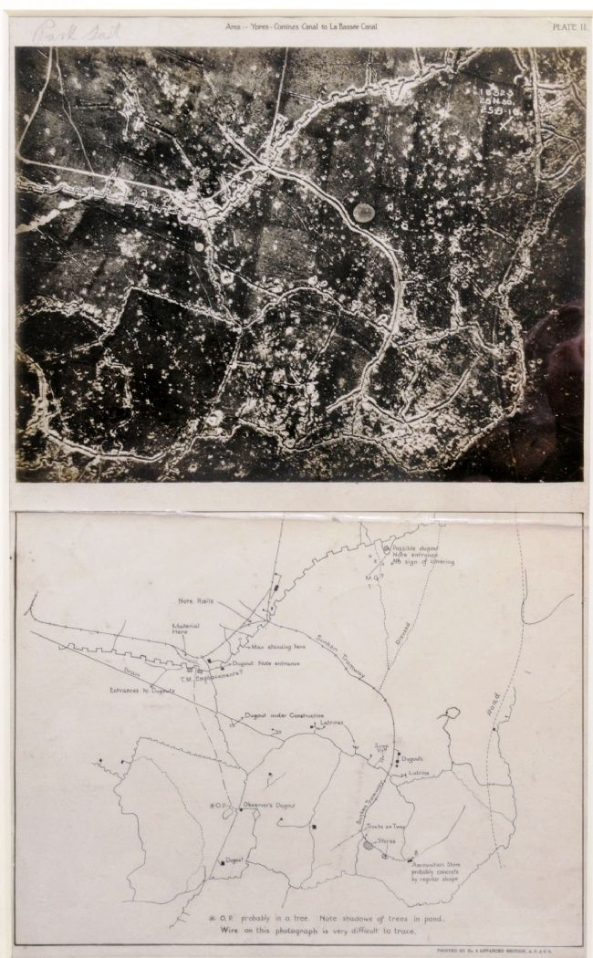
Aerial photograph and map entitled 'Area: Ypres-Comine Canal to La Bassee Canal'. The map has been annotated by hand and shows features including trenches, dugouts and latrines
The national hub for free, trusted teaching resources from cultural organisations
Aerial photograph and map entitled 'Area: Ypres-Comine Canal to La Bassee Canal'. The map has been annotated by hand and shows features including trenches, dugouts and latrines